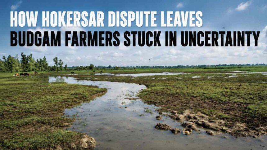
Budgam, May 6: Every morning, farmers living around the vast Hokersar Wetland walk towards their fields with the same question in mind: Will this land still remain ours tomorrow?
For years, villages surrounding the wetland — including Daharmuna, Soibugh, Gotpora and nearby areas — have remained caught in a tense and unresolved conflict between farmers and wetland authorities.
At the centre of the dispute is the long-pending demarcation of Hokersar land, a process meant to clearly separate protected wetland from agricultural land. While the government issued repeated notices and even initiated a demarcation drive, locals say the process has remained incomplete, leaving thousands of kanals in uncertainty.
ALSO READ: Over 5,700 Selections Finalised in 18 Months, Over 12,000 Posts Available With JKSSB: Govt
For farmers here, the issue is no longer just administrative. It has become deeply personal.

“We thought the problem would finally end when the government ordered demarcation,” said an elderly resident from Soibugh. “People were hopeful because land was being taken without clarity. But halfway through, everything suddenly stopped.”
The demarcation work was completed in April last year using an Electronic Total Station (ETS) machine.
According to an official order issued by the Assistant Commissioner Revenue (ACR) Budgam — DCB/SQ/2025-26/Demarcation/1426 dated 04-06-2025 — boundary pillars were supposed to be installed the following month to permanently mark the wetland limits. But on the ground, residents say those pillars never came.

“The machines came, surveys were done, officials visited, but the final markings are still missing,” said another local resident. “Without boundary pillars, confusion remains. Disputes continue. People still don’t know where the wetland ends and where farmland begins.”
Earlier, the ACR Budgam had constituted an 18-member team for the exercise, including officials from the Revenue Department, Hokersar Wetland authorities, Naib Tehsildars, block officers and patwaris from several villages.
Months later, however, villagers say the uncertainty remains exactly where it was.
For the farmers living around Hokersar, the dispute is not just about maps or records. It is about survival.
ALSO READ: Class 10 Student Dies After Falling From Double-Storey House in Bijbehara
Last year, several villages witnessed massive crop losses after water from the wetland overflowed into paddy fields. Vast stretches of farmland in Hajibugh, Narbal, Chooripora, Wadwan, Gotpora, Daharmuna, Soibugh and Arath were submerged.Many farmers claim nearly half of their rice production was lost. One farmer from the area recalled how continuous rainfall, coupled with poor maintenance of irrigation gates, turned their fields into waterlogged patches overnight.


“The water kept rising and nobody responded in time,” he said. “By the time it stopped, the crop was gone.”
Another cultivator said the situation has remained unchanged since the devastating 2014 floods.
“No dredging, no proper cleaning of canals, no repair of bunds. Every year the same thing happens and every year farmers suffer,” he said.
For many families, the damage has gone beyond crop loss. Wet fields have also increased labour costs, forcing farmers to spend more just to harvest damaged paddy.
“This year we had no option but to cut the wet crop for cattle fodder,” said a farmer from Daharmuna. “Even labour charges doubled because machines and workers could barely move in the flooded fields.”
What has further deepened anxiety is the belief among some villagers that cultivated land is gradually being marked as wetland territory.
Several locals alleged that areas where farming had been carried out for decades are now falling within the newly identified wetland boundaries, effectively stopping cultivation.“We are not against protecting Hokersar,” said a resident. “Everyone knows it is important for Kashmir. But farmers should not be pushed into uncertainty without clear demarcation.”
Hokersar is one of Kashmir’s most important wetlands, known internationally for its ecological significance. It serves as a habitat for migratory birds and acts as a natural flood buffer for the Valley.
ALSO READ: Opinion | The Arrest of a Woman Peddler and the Rise of Online Cruelty
Environmental experts say protecting the wetland is essential. But they also believe that the process must be transparent and fair to local communities whose livelihoods depend on nearby land.
Earlier this year, then Deputy Commissioner Dr. Bilal Mohi-Ud-Din Bhat visited the Hokersar site to review the demarcation work and inspect the installation of boundary pillars.
Officials said the administration is aiming for a transparent and time-bound completion of the exercise.
Following the issue, Deputy Commissioner Athar Aamir Khan chaired a high-level review meeting on April 23, 2026, to assess the progress of forest boundary demarcation, installation of boundary pillars and measures related to the removal of encroachments across the district.
DC Budgam directed the concerned departments to adopt a systematic and coordinated approach while ensuring timely completion of the ongoing demarcation initiatives.
For now, life around Hokersar continues in uncertainty — caught between conservation and cultivation, between official records and inherited land.